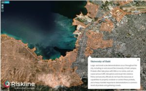
Riskline has expanded its collection of City Safety Maps to cover 150 cities worldwide and is on course to reach 200 by the end of 2019.
From Los Angeles to Suva in Fiji, Helsinki to Santiago, Port au Prince to Port Moresby, there are maps of cities in every continent, larger and smaller across the circle of the globe, west to east, north to south and many in between.
Launched at the end of 2018 with 50 maps, Riskline’s City Safety Maps bring unique street-level safety and security information, a first in the travel risk intelligence industry. Available to Riskline resellers and clients, the City Safety Maps complement Riskline’s existing portfolio of 249 City Safety Reports.
Each map was created from scratch by Riskline’s analysts using open source and human intelligence, including reports from local authorities and information from trusted local sources. Every map contains critical information and advice for travelers about specific neighborhoods and landmarks in a city, down to the street level. They clearly indicate locations that are classified as high crime zones, protest flashpoints and other areas of concern.
City Safety Maps are available through the Riskline portal as part of existing City Safety Reports, as well as through an API, which can be incorporated into travel and duty of care apps.
Riskline is currently creating a series of new reports which will be important additional assets to travelers and their employers in compliance with their duty of care.


